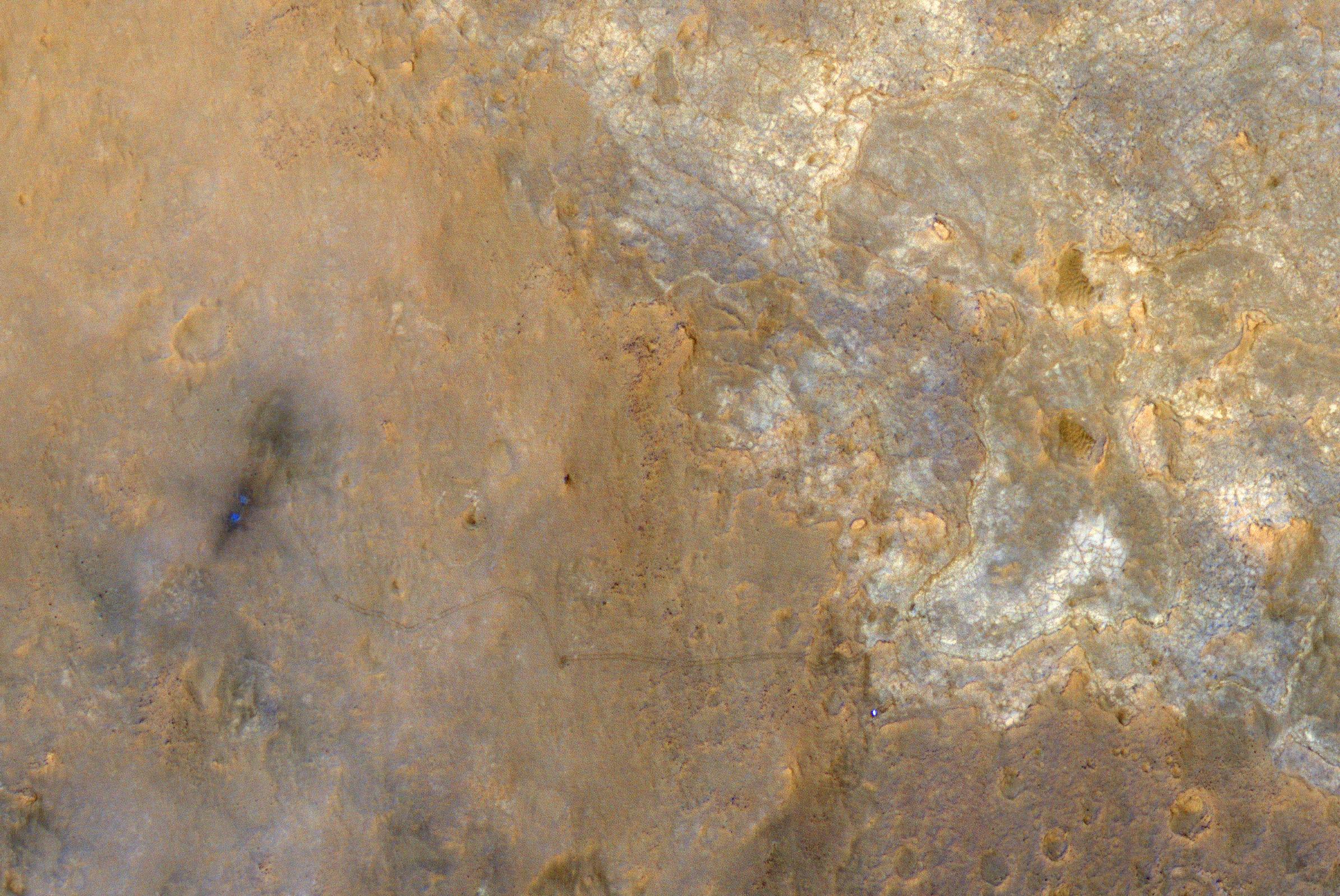
It’s been almost a year since the Mars Curiosity Rover completed its 36-week trip to the red planet, and NASA has now just released a high-resolution image of the landing site as well as the path the rover took from its landing until the photo was shot on June 27th. The image itself was shot from NASA’s Mars Reconnaissance Orbiter, using its High Resolution Imaging Science Experiment (HiRISE) camera, a massive device that’s been shooting images of Mars since 2006. Curiosity’s landing site shows up on the left side of the image, marked by two blueish dots and some scorch marks — from there you can follow the rover’s trails to the Glenelg area of the Gale Crater. Curiosity itself can be seen as a tiny blue-and-white dot in the lower right half of the image. It’s tricky to get a sense of just how far Curiosity has traveled since landing last August, but NASA notes that the rover’s tracks are about 10 feet apart — check out the full-resolution image to clearly see where Curiosity has been in its first year on Mars.
New image from NASA shows where the Curiosity rover has been since landing on Mars

Follow topics and authors from this story to see more like this in your personalized homepage feed and to receive email updates.


